
Why climb Fujisan at least once
Mount Fuji, Fujisan, is 3,776 metres high, the tallest mountain in Japan and an active stratovolcano that last erupted in 1707. For centuries it has been climbed as a pilgrimage, and a shrine, the Okumiya of Fujisan Hongū Sengen Taisha, still stands on the summit. In 2013 UNESCO listed it as a World Heritage Site as a sacred place and source of artistic inspiration, the mountain of Hokusai's prints.
It is not a technical climb. In summer the trails are wide, marked and lined with mountain huts, and families, students and retirees all make it to the top. It is, however, a long, steep walk on loose volcanic gravel to an altitude where the air is thin and the night temperature can be near freezing, even in August. The sensible plan is to climb in the official season, sleep in a hut and treat the summit sunrise as a bonus rather than a race.
For a Japanese learner the mountain is a surprisingly good classroom. The trail signs repeat the same few words, stations are counted with 合目, gōme, and every hut conversation uses the same polite questions about times, beds and distances. By the top you will have read and said them many times.
The 2026 rules: fees, bookings and gate hours
Mount Fuji sits on the border of Yamanashi and Shizuoka prefectures, and each runs its own trails and rules. Both now charge a per-person trail fee for each climb and both close the trail gates at the fifth stations from 2 p.m. until 3 a.m. the next morning. During those hours only hikers with a mountain-hut reservation may pass. The aim is to stop bullet climbing, dangan tozan, where people start at night and climb straight to the summit without sleep.
On the Yamanashi side, the Yoshida Trail uses an online reservation system run by the prefecture, and you can also pay at the gate on the day. There is a cap of 4,000 climbers a day who are not staying in a hut, and when it is reached the gate closes. Staff at the gate also check that you have cold-weather clothing, rainwear with a separate jacket and trousers, and proper hiking shoes; without all three you are not let through.
On the Shizuoka side, the Fujinomiya, Subashiri and Gotemba trails use the Shizuoka FUJI NAVI app. You register your climb date and whether you are staying at a hut, complete a short e-learning module on rules and manners, pay the fee and receive an entry certificate as a QR code to show at the fifth station. You can also register on site, which takes longer.
In 2026 the season ran from 1 July on the Yoshida and Subashiri trails and from 10 July on the Fujinomiya and Gotemba trails, to 10 September on all four. Check the official sites for next season's dates and the current fee before you plan.
- Yoshida Trail (吉田ルート): the most popular, with the most huts; starts at the Fuji Subaru Line fifth station.
- Fujinomiya Trail (富士宮ルート): the shortest and steepest, from the south, starting highest of the four.
- Subashiri Trail (須走ルート): through forest at first, joining the Yoshida Trail near the top.
- Gotemba Trail (御殿場ルート): the longest, starting low on the south-east side, with few huts.
Getting there: the Fuji Subaru Line fifth station
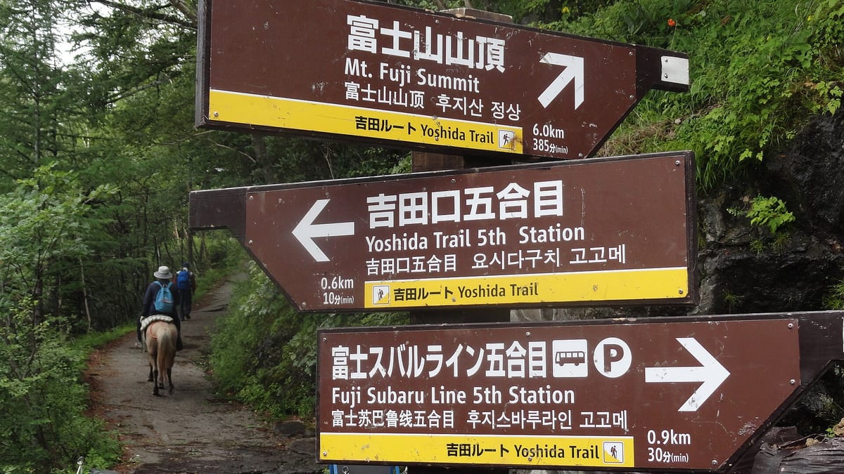
Most first-time climbers start from the Fuji Subaru Line fifth station, Fuji Subaru Rain Gogōme, at around 2,300 metres on the Yoshida Trail. In the climbing season buses run there from Kawaguchiko Station, the terminus of the Fujikyū railway, in about fifty minutes, and direct highway buses run from the Shinjuku Expressway Bus Terminal in Tokyo in about two and a half hours. Private cars are banned from the Subaru Line in summer, so you arrive by bus or taxi.
For the Fujinomiya Trail, seasonal buses leave from Shin-Fuji Station on the Tōkaidō Shinkansen and from Mishima and Fujinomiya stations. In peak season some buses fill up, so buy your ticket early and keep your return ticket safe. Plan your descent to reach the fifth station before the last bus down.
| Japanese | Romaji | Meaning |
|---|---|---|
| 富士スバルライン五合目行きのバスはどこですか。 | Fuji Subaru Rain gogōme yuki no basu wa doko desu ka. | Where is the bus to the Fuji Subaru Line fifth station? |
| 五合目まで往復で一枚お願いします。 | Gogōme made ōfuku de ichimai onegai shimasu. | One return ticket to the fifth station, please. |
| 最終バスは何時ですか。 | Saishū basu wa nanji desu ka. | What time is the last bus? |
| 吉田ルートの入口はどちらですか。 | Yoshida rūto no iriguchi wa dochira desu ka. | Which way is the entrance to the Yoshida Trail? |
| 予約のQRコードはこちらです。 | Yoyaku no QR kōdo wa kochira desu. | Here is my booking QR code. |
From the fifth station to the crater: what you will pass
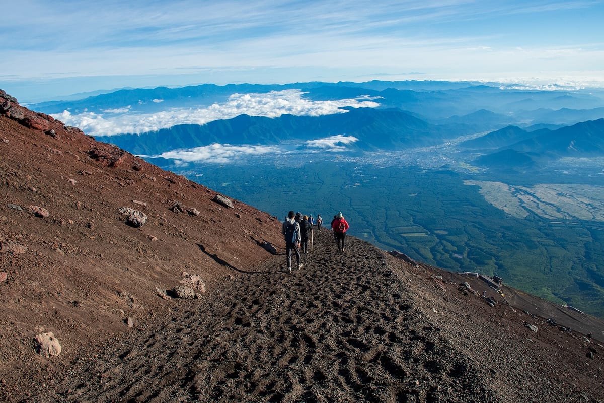
Mount Fuji is divided into ten stations, gōme, from the foot to the summit. The fifth stations are where the roads end and the modern climb begins. On the Yoshida Trail the path first contours gently through the last trees to the sixth station, where there is a safety guidance centre, then climbs in zigzags over bare red and black rock to the huts of the seventh and eighth stations, strung one above the other along the slope.
Above the eighth station the huts thin out, the air gets noticeably thinner and the final stretch to the crater rim is slow for everyone. On the Yoshida Trail the way down is a separate descent trail, gezandō, a long run of zigzags on loose gravel, so follow the signs at the top rather than going back the way you came.
- Gogōme (五合目): the fifth station, with shops, toilets, a bus terminal and the trail gate.
- Roku-gōme (六合目): the sixth station and the Yoshida Trail safety guidance centre.
- Nana-gōme and hachi-gōme (七合目・八合目): the hut stations where most people sleep.
- Kongōzue (金剛杖): the wooden hiking staff sold at the fifth station; many huts will burn a station stamp into it for a small fee.
- Goraikō (ご来光): the sunrise, watched from the rim or from the slope just below it.
- Ohachi-meguri (お鉢巡り): the walk round the crater rim, about an hour and a half.
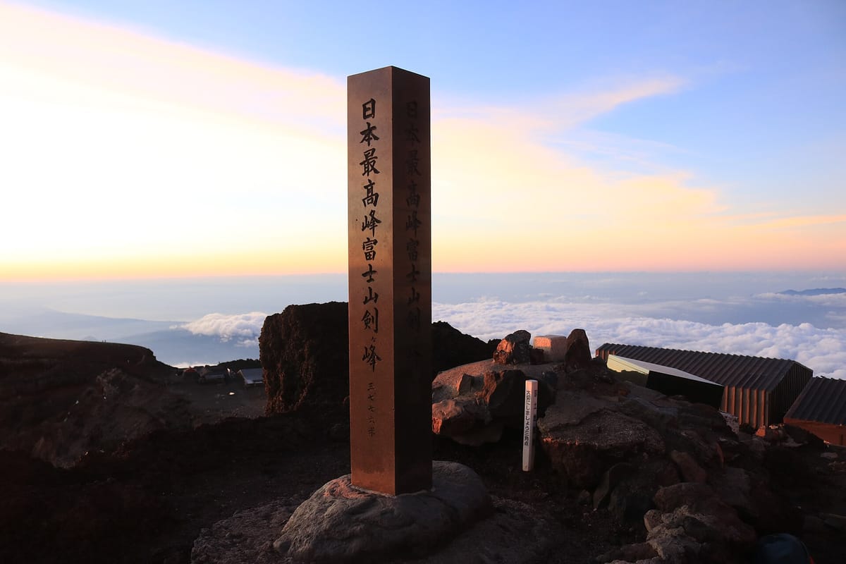
- Kengamine (剣ヶ峰): the highest point, 3,776 metres, on the far side of the crater from the Yoshida Trail.
Words on the trail signs
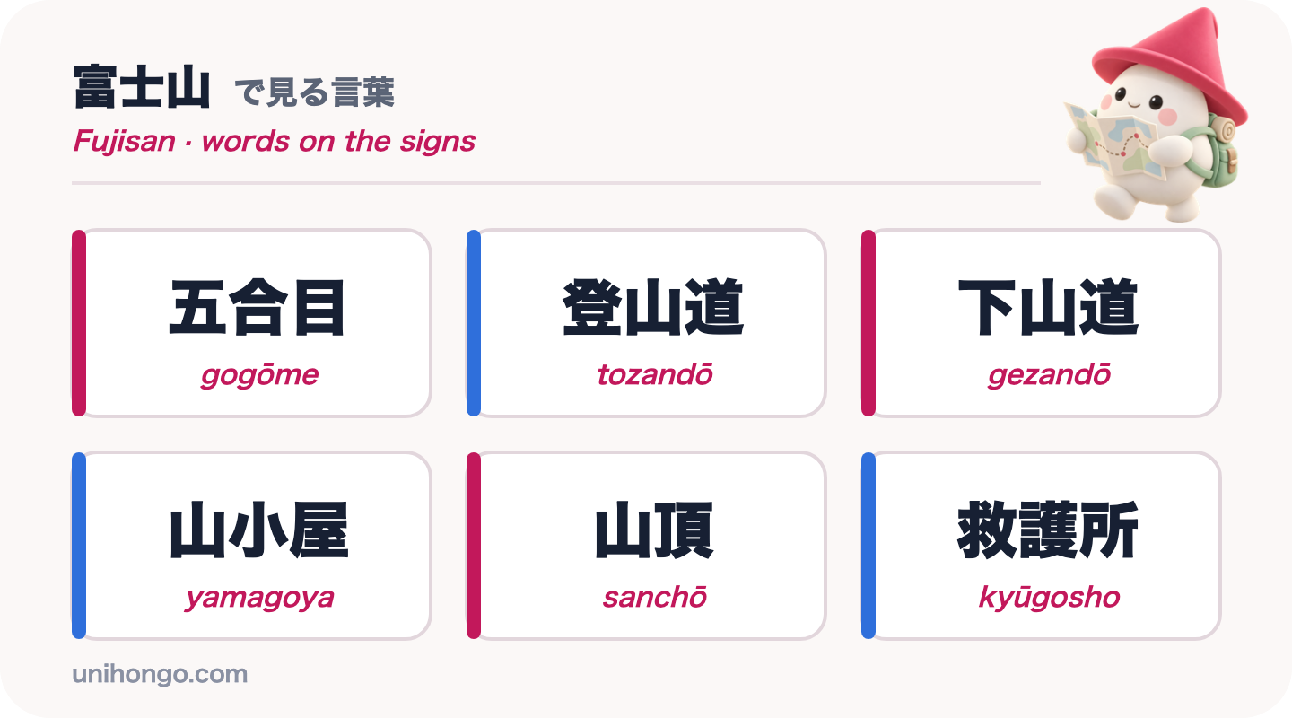
Two signs matter more than any others. 登山道, tozandō, is the climbing trail and 下山道, gezandō, is the descent trail: the kanji 登 means climb and 下 means down. On the Yoshida Trail they split at the eighth station, and taking the wrong one on the way down can bring you out on a different side of the mountain, far from your bus.
The station names use 合目, gōme, with a number in front, and every hut displays its station and altitude on its sign. The table below covers the words you will read on the way up and down.
| Word | Reading | Meaning |
|---|---|---|
| 五合目 | gogōme | Fifth station, where the trails start |
| 登山道 | tozandō | Climbing trail, the way up |
| 下山道 | gezandō | Descent trail, the way down |
| 山小屋 | yamagoya | Mountain hut |
| 山頂 | sanchō | Summit |
| 救護所 | kyūgosho | First-aid post |
| 吉田ルート | Yoshida rūto | Yoshida Trail |
| 標高 | hyōkō | Altitude, written on hut signs |
| 落石注意 | rakuseki chūi | Beware of falling rocks |
Japanese at the mountain hut
Fuji's huts, yamagoya, are simple and crowded: shared bunk platforms, a set dinner, often curry, and an early wake-up for the summit. You book in advance and pay the hut directly. Check-in means giving your name, confirming meals and hearing when lights go out. Staff are busy and speak quickly, so it helps to have the key questions ready.
Toilets on the mountain are maintained by the huts and usually ask for a small payment, so carry plenty of coins. Water is sold rather than free, and prices rise with altitude, which is one reason to fill your bottles at the fifth station.
| Japanese | Romaji | Meaning |
|---|---|---|
| 今夜予約しています。名前はスミスです。 | Kon'ya yoyaku shite imasu. Namae wa Sumisu desu. | I have a booking for tonight. My name is Smith. |
| 夕食は何時からですか。 | Yūshoku wa nanji kara desu ka. | What time does dinner start? |
| ご来光は何時ごろですか。 | Goraikō wa nanji goro desu ka. | About what time is the sunrise? |
| 朝ごはんはお弁当にできますか。 | Asagohan wa o-bentō ni dekimasu ka. | Can I have breakfast as a packed meal? |
| 荷物をここに置いてもいいですか。 | Nimotsu o koko ni oite mo ii desu ka. | May I leave my bag here? |
| この杖に焼印をお願いします。 | Kono tsue ni yakiin o onegai shimasu. | Please brand a stamp on this staff. |
| 頭が痛くて、気分が悪いです。 | Atama ga itakute, kibun ga warui desu. | I have a headache and feel sick. |
Safety, etiquette and timing on the mountain
Fuji looks gentle from a distance but it causes accidents every summer, most of them from exhaustion, cold and falls on the descent. Treat it as a real mountain.
- Climb only in the official season, when huts, first-aid posts and trail staff are there.
- Pack warm layers, a hat, gloves, a headlamp, a separate rain jacket and trousers and proper boots; the summit can be close to freezing before dawn.
- Go slowly, drink often and rest at every station. If altitude sickness sets in, going down is the cure.
- Carry all your rubbish down with you. There are no bins on the trail.
- Keep quiet in the huts after lights out: people around you are sleeping for a few hours before a 2 a.m. start.
- Do not take volcanic rocks as souvenirs, and stay on the marked trail.
- Weekends and the Obon holiday in mid-August are the busiest; weekdays in July and early September are calmer.
Practise the climb before you go
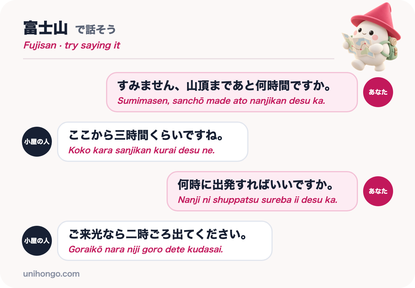
The conversation you are most likely to have on Fuji is at the hut the evening before the summit push: how far is it, and when should I leave? The answers come in hours with kurai or goro, about, attached, and the staff will often tell you to leave earlier than you expect because of queues on the final stretch.
Practise the four lines below until you can say them without reading. Then rehearse with someone who answers back: in Unihongo, choose the Sightseeing topic and ask your AI Sensei to play the hut staff, and change the times each round so you practise catching the numbers.
| Japanese | Romaji | Meaning |
|---|---|---|
| すみません、山頂まであと何時間ですか。 | Sumimasen, sanchō made ato nanjikan desu ka. | Excuse me, how many more hours to the summit? |
| ここから三時間くらいですね。 | Koko kara sanjikan kurai desu ne. | About three hours from here. |
| 何時に出発すればいいですか。 | Nanji ni shuppatsu sureba ii desu ka. | What time should I set off? |
| ご来光なら二時ごろ出てください。 | Goraikō nara niji goro dete kudasai. | For the sunrise, please leave around two. |
Official information
Fees, booking systems, season dates and trail conditions change from year to year and are published by the two prefectures. Check both sites before you plan, and again the week you climb, because opening can be delayed and trails can close after storms.