

Why walk the Kumano Kodō
Kumano, in the south of the Kii Peninsula, was long believed to be a land where gods lived in the mountains, waterfalls and rivers. From the tenth century onwards retired emperors, nobles and later ordinary people walked here from Kyoto on pilgrimages that took weeks, to pray at the three grand shrines, the Kumano Sanzan: Kumano Hongū Taisha, Kumano Hayatama Taisha and Kumano Nachi Taisha. The trails they used are the Kumano Kodō, the old roads of Kumano, registered in 2004 as part of the UNESCO World Heritage site covering the sacred sites and pilgrimage routes of the Kii Mountain Range.
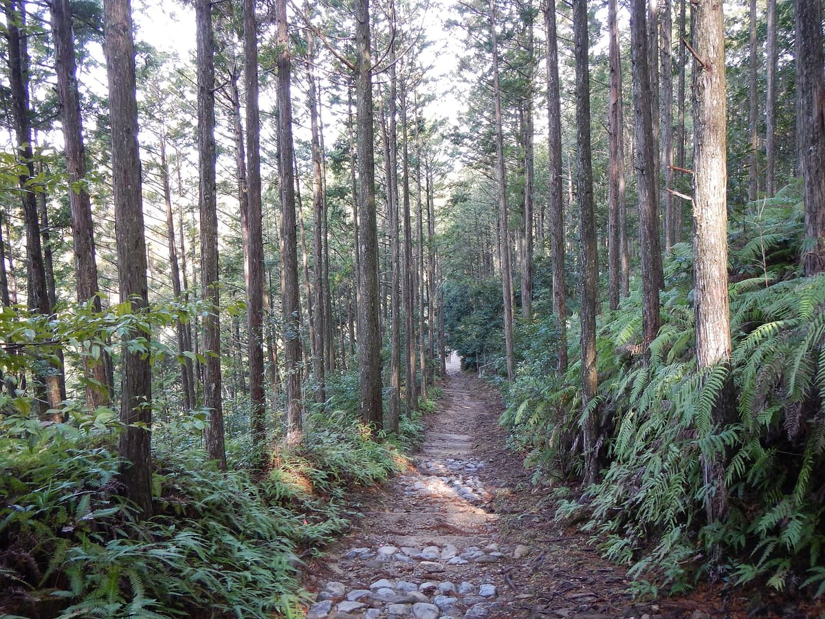
Of the several routes, the Nakahechi is the one to walk first. It climbs from Takijiri-ōji, the traditional entrance to the sacred area, over forested ridges to small villages such as Takahara and Chikatsuyu and down to Hongū, passing dozens of ōji, the small shrines that marked the pilgrims' progress. It is a real mountain walk with steep stone steps, but it is well signed, and every night ends at a family-run inn with a hot bath and a big dinner.
For a Japanese learner, the Kumano Kodō gives something the cities cannot: slow, repeated, friendly conversations. You greet other walkers, ask farmers if you are on the right path, talk to the family who runs your inn and order tomorrow's lunch. Few people in the villages speak much English, and they are used to walkers trying a little Japanese.
Getting there: Kii-Tanabe, Takijiri and Hosshinmon-ōji
The gateway town for the Nakahechi is Tanabe, on the west coast of Wakayama. From Shin-Osaka or Tennōji, take a JR Kuroshio limited express on the Kisei Line to Kii-Tanabe Station, a journey of a little over two hours. The Tanabe tourist information centre is right by the station and sells maps and gives bus advice. Nanki-Shirahama Airport, with flights from Tokyo, is a short bus ride away.
From the bus stop outside Kii-Tanabe Station, local buses run inland along the route. Get off at Takijiri to start the full walk at the Kumano Kodō-kan pilgrimage centre and Takijiri-ōji. For the half-day walk, take a bus to Hosshinmon-ōji: services run from Kii-Tanabe via the hot spring villages, and it is easiest to stay near Hongū the night before and ride up in the morning. Buses into the mountains are infrequent, so check the timetable the day before and note the last bus back.
| Japanese | Romaji | Meaning |
|---|---|---|
| 紀伊田辺までの特急券をお願いします。 | Kii-Tanabe made no tokkyūken o onegai shimasu. | A limited express ticket to Kii-Tanabe, please. |
| 滝尻に行くバスはどこから出ますか。 | Takijiri ni iku basu wa doko kara demasu ka. | Where does the bus to Takijiri leave from? |
| このバスは発心門王子まで行きますか。 | Kono basu wa Hosshinmon-ōji made ikimasu ka. | Does this bus go to Hosshinmon-ōji? |
| 本宮行きの最終バスは何時ですか。 | Hongū-yuki no saishū basu wa nanji desu ka. | What time is the last bus to Hongū? |
| 着いたら教えていただけますか。 | Tsuitara oshiete itadakemasu ka. | Could you tell me when we arrive? |
The Nakahechi stage by stage, and Hongū's giant torii
The full Nakahechi from Takijiri-ōji to Kumano Hongū Taisha is about 38 kilometres. Most walkers split it in two or three days. The first day, from Takijiri to Chikatsuyu, is about 13 kilometres and the hardest: a steep climb straight from the trailhead, past the hilltop village of Takahara with its famous view over the mountains, then along ridges to the Chikatsuyu valley. Some people stop the first night at Takahara to shorten it.
From Chikatsuyu the trail continues through forest and tiny hamlets past Tsugizakura-ōji to Hosshinmon-ōji, the gate of awakening. The last 7.5 kilometres from Hosshinmon-ōji to Hongū are the gentlest and the most popular as a half-day walk: down through villages and tea fields to Fushiogami-ōji, where pilgrims had their first view of the sacred area, and through cedar forest to the back of Kumano Hongū Taisha.
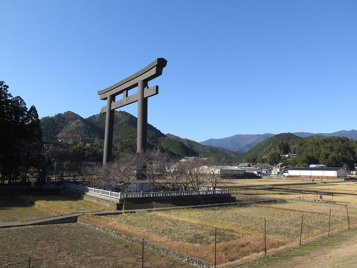
Hongū Taisha stands at the top of a long flight of stone steps, with dark, cypress-bark roofs and banners of the Yatagarasu, the three-legged crow that is the messenger of the Kumano deities. The shrine originally stood on Ōyunohara, a sandbank where rivers meet, until a flood in 1889 destroyed much of it; the surviving buildings were moved to the present site. Ōyunohara is now marked by a torii built in 2000 that is about 34 metres tall, among the largest in the world, and you can walk to it from the shrine in a few minutes.
- Takijiri-ōji: trailhead shrine and the Kumano Kodō-kan pilgrimage centre.
- Takahara: a ridge-top village with a wide mountain view, the first village on the climb.
- Chikatsuyu: the valley village where most walkers spend the first night.
- Hosshinmon-ōji: start of the half-day walk to Hongū.
- Fushiogami-ōji: the viewpoint where pilgrims first saw Hongū.
- Kumano Hongū Taisha: the grand shrine at the end of the Nakahechi.
- Yunomine Onsen: a hot spring village near Hongū with Tsuboyu, a tiny bath in a rock hollow that takes a few people at a time.
Words on the trail signs
The trail is marked by wooden signposts with the route name, the direction and a number that tells you where you are on the map. Most have English, but bus fronts, village signs and inn names are often in Japanese only, and several place names use unusual readings: 近露 is Chikatsuyu and 大斎原 is Ōyunohara, readings you would never guess from the kanji.
Learn to spot 王子, ōji, and 大社, taisha, grand shrine, and you can follow the whole pilgrimage on any map.
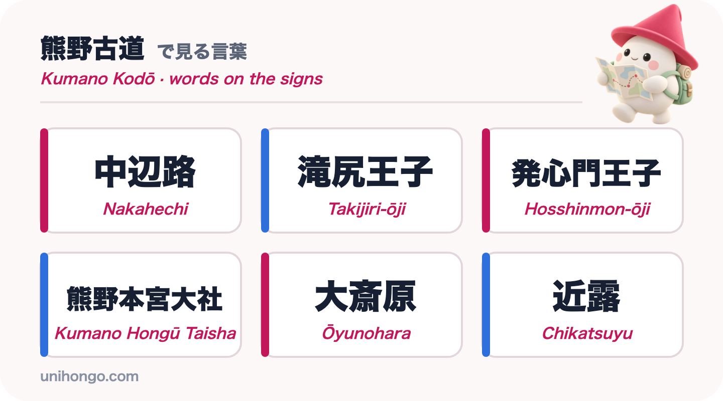
| Word | Reading | Meaning |
|---|---|---|
| 熊野古道 | Kumano Kodō | The old pilgrimage roads of Kumano |
| 中辺路 | Nakahechi | The central route from Tanabe to Hongū |
| 王子 | ōji | Small subsidiary shrine along the route |
| 滝尻王子 | Takijiri-ōji | Trailhead shrine of the Nakahechi |
| 近露 | Chikatsuyu | Village where many walkers spend the first night |
| 発心門王子 | Hosshinmon-ōji | Start of the half-day walk to Hongū |
| 熊野本宮大社 | Kumano Hongū Taisha | The grand shrine at the end of the route |
| 大斎原 | Ōyunohara | Original shrine site with the giant torii |
| 湯の峰温泉 | Yunomine Onsen | Hot spring village near Hongū |
| 通行止め | tsūkōdome | Closed, no through route |
Japanese at the village inn: dinner, bath and a packed lunch
Accommodation on the Nakahechi is mostly minshuku, small family-run guesthouses, and a few ryokan and guesthouses in the villages. Rooms are limited and the hosts cook dinner and breakfast for the guests they expect, so everything must be booked ahead, usually through the Kumano Travel reservation system run by the local tourism bureau. Most inns will also make a bentō, a packed lunch, for the next day's walk if you order it in advance; there are few shops or restaurants on the trail itself.
The conversations at an inn are predictable: when dinner is, how the bath works, whether you can have a lunch box tomorrow, and whether your luggage has arrived by shuttle. The phrases below cover them all.
| Japanese | Romaji | Meaning |
|---|---|---|
| 今晩予約しているスミスです。 | Konban yoyaku shite iru Sumisu desu. | I'm Smith, I have a booking for tonight. |
| 荷物は届いていますか。 | Nimotsu wa todoite imasu ka. | Has my luggage arrived? |
| 明日のお弁当をお願いできますか。 | Ashita no o-bentō o onegai dekimasu ka. | Could I order a packed lunch for tomorrow? |
| 朝ごはんは何時からですか。 | Asagohan wa nanji kara desu ka. | What time is breakfast? |
| 水をもらえる所はありますか。 | Mizu o moraeru tokoro wa arimasu ka. | Is there somewhere I can get water? |
| 明日は雨ですか。 | Ashita wa ame desu ka. | Will it rain tomorrow? |
| カードは使えますか。 | Kādo wa tsukaemasu ka. | Can I pay by card? |
Etiquette, timing and practical tips on the trail
The Kumano Kodō is a pilgrimage route through working villages and sacred forest. A few habits keep the walk safe and pleasant for everyone.
- Greet other walkers and villagers with konnichiwa; a small greeting is part of trail culture.
- Stay on the marked path, and take all your rubbish with you: there are almost no bins.
- The area has high rainfall. Carry rain gear every day and check the forecast in the morning.
- Start early and aim to reach your inn by mid-afternoon. In winter the valleys get dark early.
- Fill your water bottle at the inn before you set off; stream water is not tested.
- Bow at the torii of each ōji and the grand shrines, and walk to the side of the path through the gates.
- Walking is the only way on the trail: bicycles are not allowed on the pilgrimage paths.
- In an emergency call 119 for an ambulance or 110 for the police.
Practise the trail Japanese before you go
The conversation you will have again and again on the Nakahechi is about the way and the distance. Where the path crosses a village road it is easy to lose the markers, and a local working in a field will happily point you on. Practise the four lines below until you can say them without reading, and listen for the number and the word kiro, kilometres, in the answer.
Then practise with a partner who answers back. In Unihongo, choose the Directions topic and ask your AI Sensei to play a villager on the Kumano Kodō, or the Ryokan Stay topic to rehearse checking in at a minshuku and ordering tomorrow's bentō. Saying the lines once before the trip makes them come out easily on the trail.
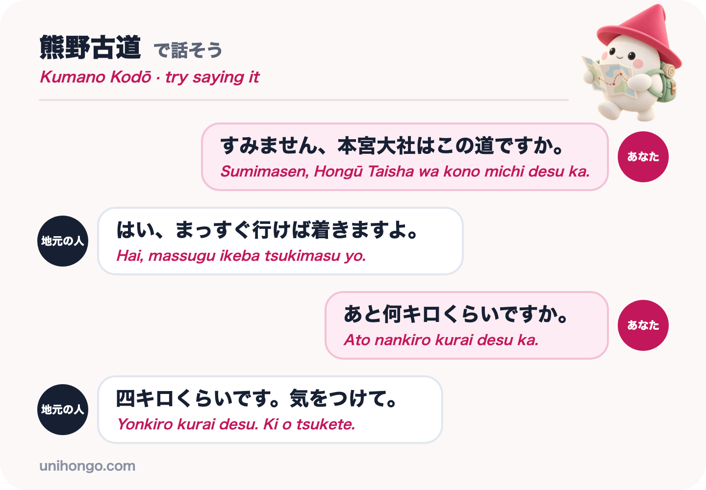
| Japanese | Romaji | Meaning |
|---|---|---|
| すみません、本宮大社はこの道ですか。 | Sumimasen, Hongū Taisha wa kono michi desu ka. | Excuse me, is this the way to Hongū Taisha? |
| はい、まっすぐ行けば着きますよ。 | Hai, massugu ikeba tsukimasu yo. | Yes, keep going straight and you'll get there. |
| あと何キロくらいですか。 | Ato nankiro kurai desu ka. | About how many kilometres are left? |
| 四キロくらいです。気をつけて。 | Yonkiro kurai desu. Ki o tsukete. | About four kilometres. Take care. |
Official information
The Tanabe City Kumano Tourism Bureau publishes route maps, walking times, trail condition notices, bus information, the luggage shuttle and the Kumano Travel lodging reservations. Check trail notices before you set off, as sections can close after typhoons or heavy rain.